Which Auckland fishing spots are still open after the 2025 Hauraki Gulf marine protections? Updated guide to 17 inner Gulf marks, with closures flagged.
Important update - Hauraki Gulf Marine Protection Areas
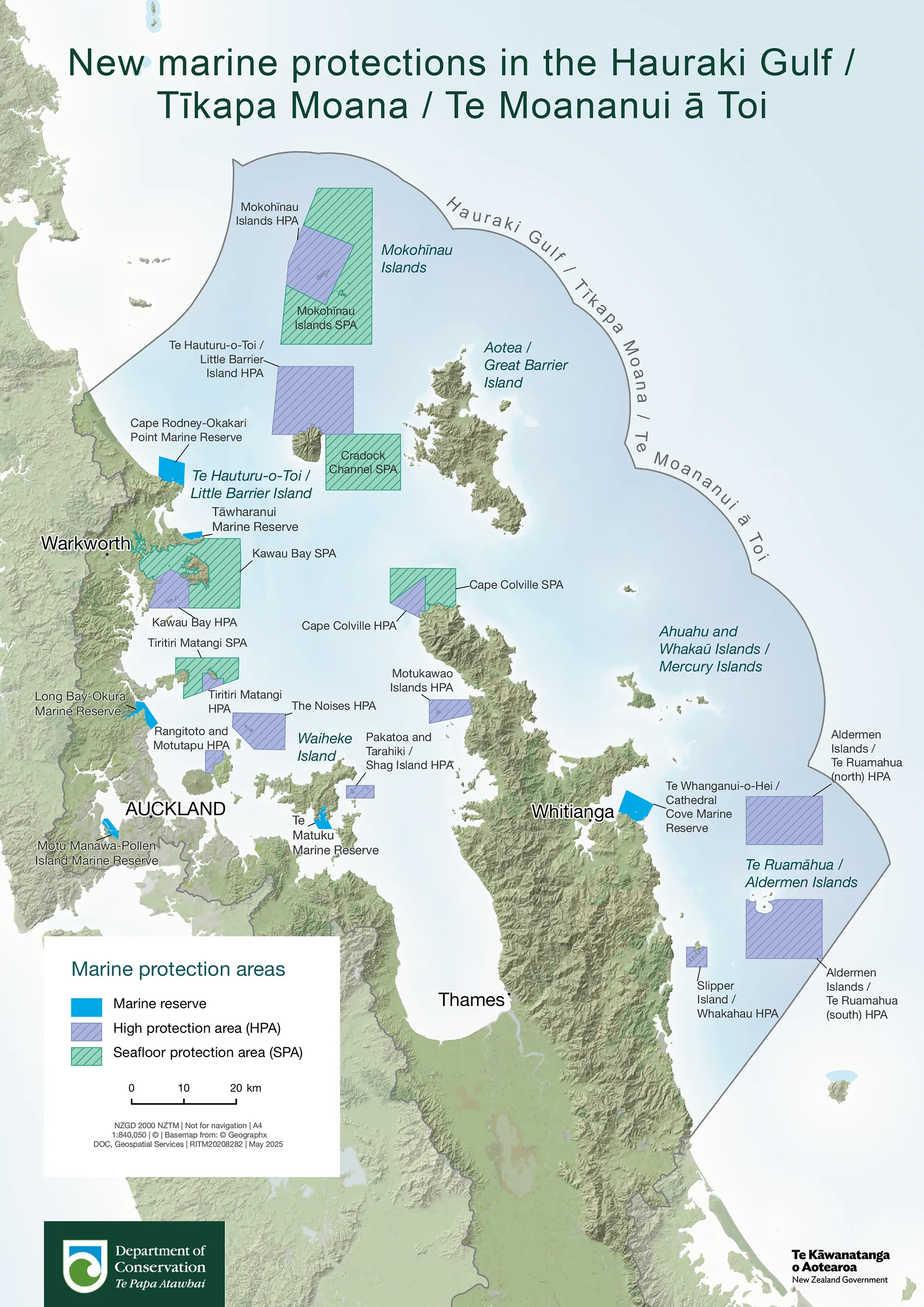
On 25 October 2025, the Hauraki Gulf / Tīkapa Moana Marine Protection Act came into force. It's the largest expansion of marine protection in the Gulf in over a decade, and it changes the rules at three of the spots in this guide. Before you head out, read the quick rundown below; then check each numbered spot for its current status. The DOC overview map and the free MarineMate app are the easiest ways to confirm boundaries on the water. See full details at the bottom of the post.
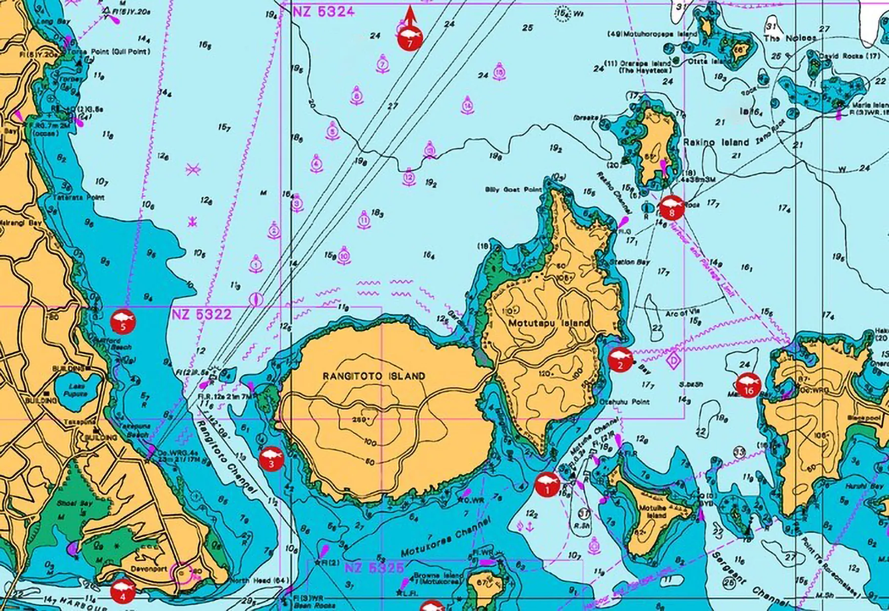
The spots
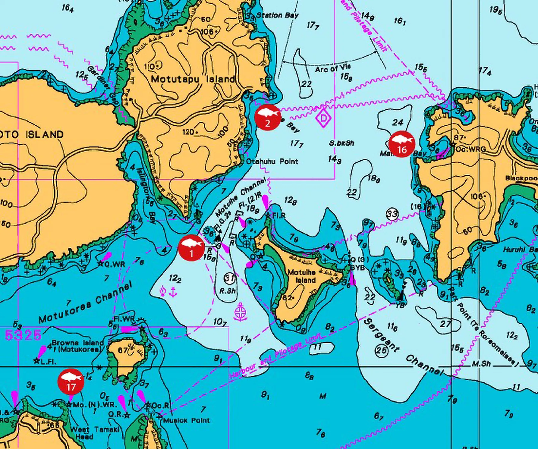
1. Motuihe Channel (snapper)
Subject to enormous current flows but very productive once you figure out its vagaries. Does get crowded though.
2. Home Bay (snapper)
Fish in depths of between 7m and 12m. Usually most productive at change of light in the morning, although it does produce good fish on the outgoing tide during the day at times. Straylined pilchards and squid or lightly weighted softbaits usually deliver the best results.
3. Rangitoto Channel (snapper)
Once autumn kicks in, bigger fish are regularly caught in this area. The zone around Rangitoto Lighthouse can be particularly productive in the evening.
4. Battleship, Auckland Harbour (snapper)
In the summer months when the snapper come in close to spawn, drift with softbaits or bait along the banks of the Auckland Harbour. Often either side of high or low tide will work.
5. Castor Bay (snapper)
Can produce some big snapper in autumn, especially at the change of light. Anchor around 500m from the cliffs with bait and berley, or drift slightly further out when softbaiting.
6. (Removed as likely to be closed)
7. Tiritiri Island (snapper)
Status: Closed to fishing inside the Tiritiri Matangi HPA. The wider Tiritiri Matangi SPA extends further out; line fishing remains legal in the SPA.
8. Awash Rock (snapper)
Great area to softbait through during the summer. Plenty of table fish and the odd bigger one to be taken, especially in spring. Fishes best mid-tide when the current is running.
9. (Removed as now closed)
10. (Removed as now closed)
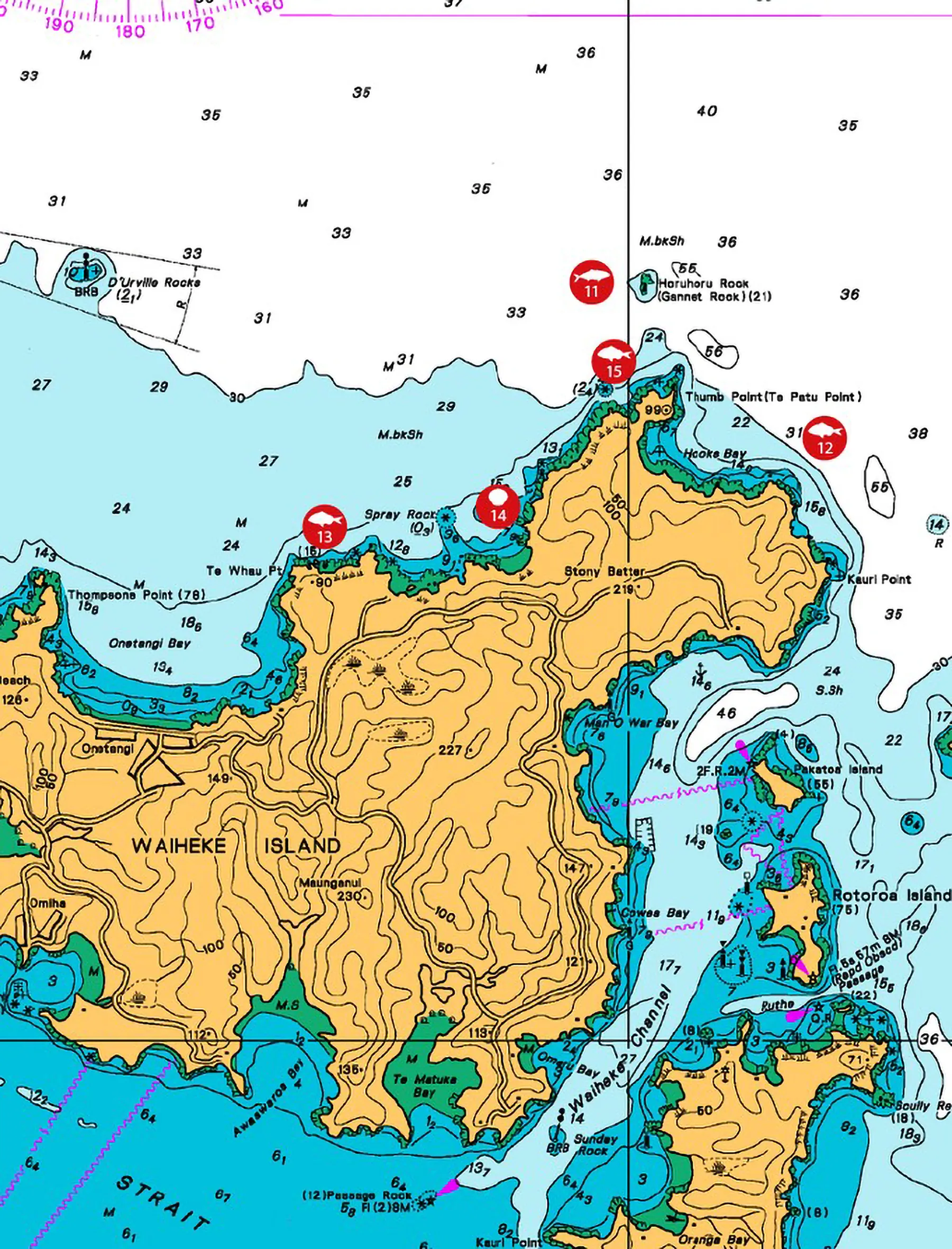
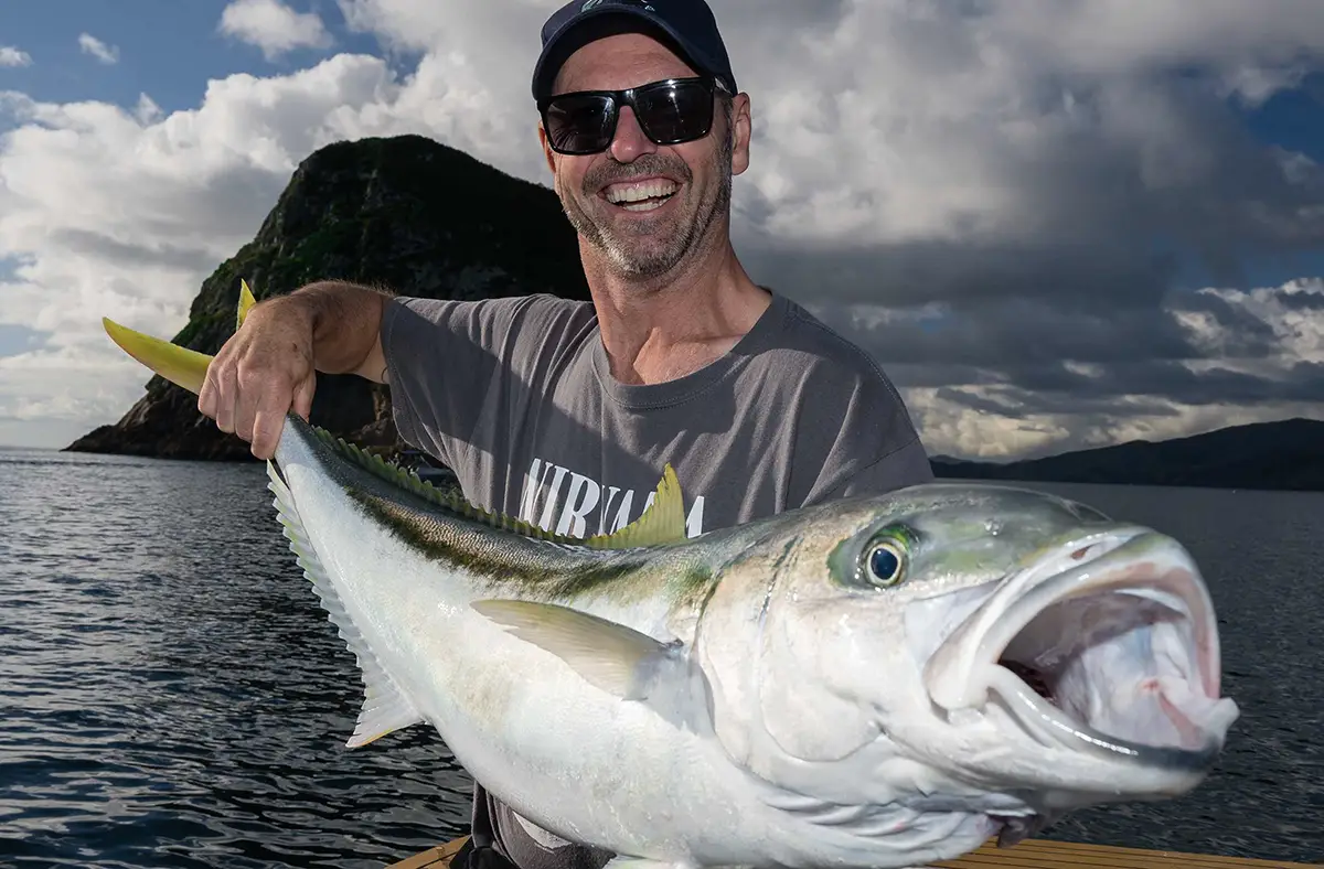
11. Gannet Rock / Horuhoru Rock (snapper, kingfish)
Gannet Rock can be productive all year round but especially in autumn. Look for bottom structure and try ledger or flasher rigs with thinly cut baits. Note that the southern boundary of The Noises HPA is not far north of here, so make sure your drift doesn't carry you into closed water.
12. Bottom end of Waiheke (snapper)
Lots of areas to target around and in Hooks Bay. This rock also holds kingfish from time to time in summer. Kauri Point can fire as kingfish chase bait around the mussel farm. Heavier jigs of 200 to 250g, or slow pitch jigs of 150 to 200g, would be a good tactic.
13. Te Whau to Matapihi Point (snapper)
Good snapper can be caught when the conditions allow the boat stern to face toward the shore. Straylining unweighted baits with plenty of berley.
14. Owhiti Bay (scallops)
A quick snorkel can well be worth the effort as scallops can often be found anywhere from close to the beach in three metres out to twelve metres deep. Note: the recreational scallop fishery across the upper North Island, including the Hauraki Gulf, has been closed under a Fisheries NZ rāhui since 2022 and remains closed at the time of writing. This restriction is separate from the new marine protections. Check fisheries.govt.nz for the current status before planning a snorkel here.
15. Ruruwhango Bay (snapper)
Given the right conditions this spot can really fire, especially on the change of light and approaching the top of the tide.
16. Matiatia, Waiheke Island (snapper)
Softbaiting across this bay at first light gives you a good chance of pannies and the occasional bigger snapper too. The Te Matuku Marine Reserve on the south side of Waiheke (which predates the 2025 changes) remains no-take, so don't drift across the southern coastline without checking your position.
17. Musick Point (snapper)
Best fished on an incoming tide. Distance is key at this spot as there's a lot of foul ground just metres off the main rock. Pilchards tend to work best at dusk.
What the three new protection types mean for anglers
There are now three tiers of protection, and the rules differ sharply between them.
Marine reserves
Fully no-take. Nothing comes out of the water; no fish, shellfish, crayfish, rocks or driftwood. Swimming, snorkelling, diving and boating are fine.
High Protection Areas (HPAs)
Prohibit all commercial and recreational fishing, including hand-gathering of crayfish, scallops and other shellfish. Anchoring is still allowed, and customary fishing under written authorisation can continue. Two HPAs (Rangitoto and Motutapu, and Kawau Bay) have a narrow commercial ring-net exception for kahawai, grey mullet and trevally between 1 March and 31 August, subject to review in 2028. That exception does not apply to recreational anglers.
Seafloor Protection Areas (SPAs)
The lightest touch of the three. They prohibit bottom trawling, dredging and Danish seining, but line fishing, soft-baiting, jigging, spearfishing and diving for seafood are all still permitted. Careful anchoring is also fine.
If you're unsure where a boundary sits, drop the location into MarineMate or check the DOC GPX files. Boundaries follow straight lines between coordinates, not coastlines, so it's worth knowing exactly where you are.
Before you go
A few things worth knowing as the new system beds in.
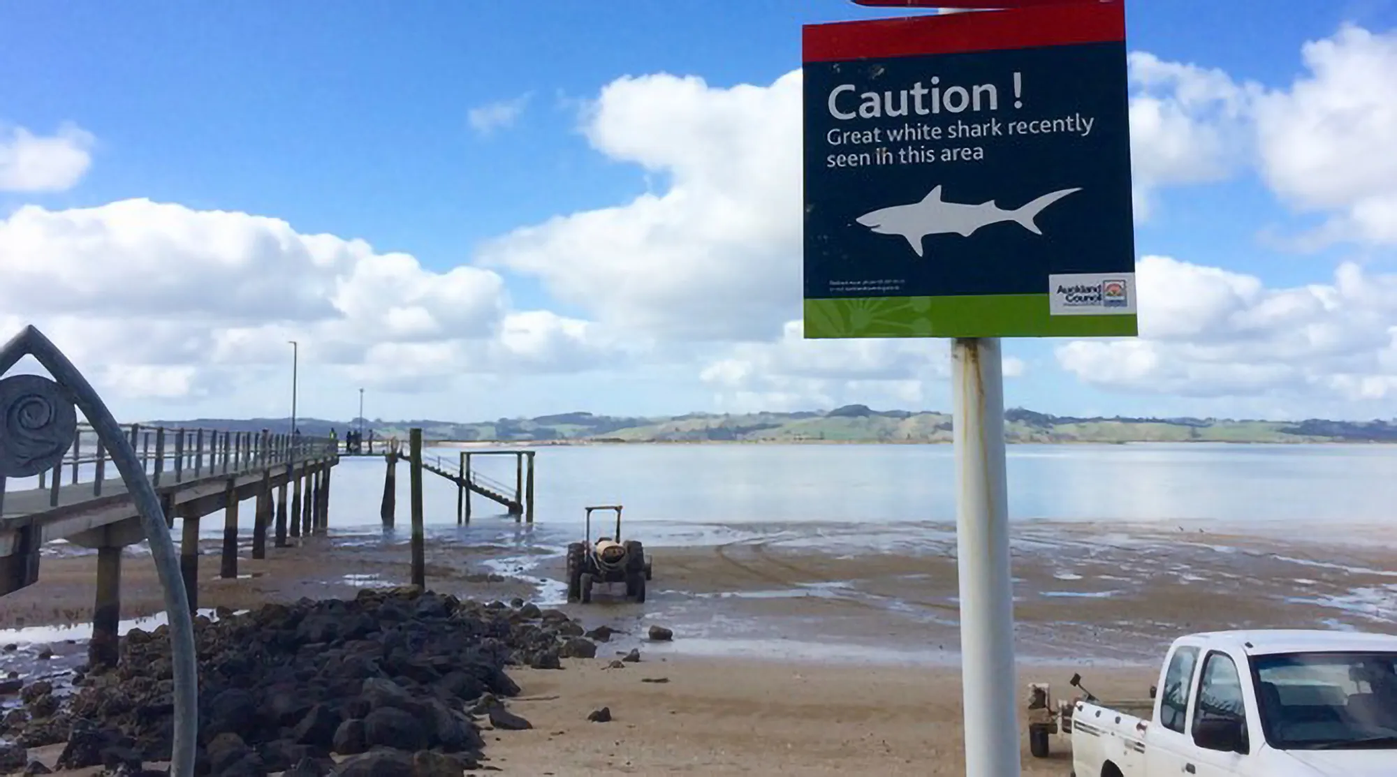
DOC has marine rangers operating from Warkworth, Auckland's North Shore and Whitianga. They'll be running an educational focus through the first summer of the new rules, with signage at boat ramps and updated boundaries being pushed out to commercial chart-plotter providers. Compliance patrols, drone monitoring and high-zoom CCTV are being rolled out alongside that education work.
If you're fishing close to a boundary, the MarineMate app is the fastest way to confirm whether you're inside or outside a protection area on the water. The DOC site also publishes individual maps and GPX files for each protection area, which you can load into a chartplotter.
The full rules and area-by-area maps are at doc.govt.nz/marine-protection-maps.
Map zoom available on mobile device browser
Checkout the Angler's Planet Hauraki Gulf reports page for up to date fishing reports